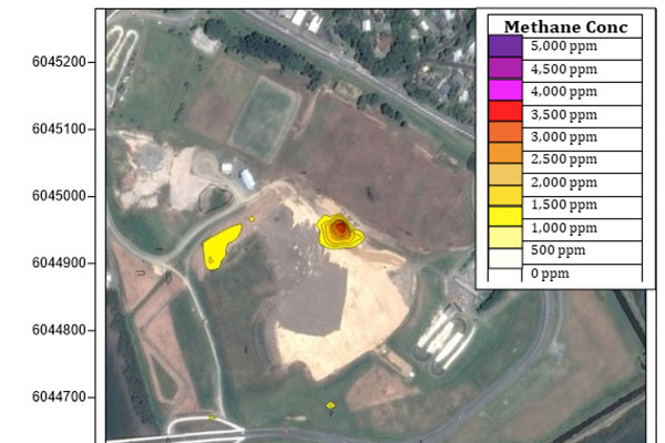
Surveying methane emissions from landfill caps and automated remote measurement of contaminant emissions is regularly required as part of managing closed landfills.
Surveying landfill caps

Surveys are often timed to coincide with extended periods of low rainfall and lower soil moisture content and a falling atmospheric pressure as this is associated with elevated methane emissions in a process commonly referred to a “barometric pumping”.
The instrument used is a tuneable laser diode with an 6 metre path length mounted on a small ATV(all-terrain vehicle). The low powered tuneable laser operates in the near infra-red range and has a minimum detection limit of 1 ppm methane (atmospheric methane is about 1.8ppm). The laser oscillates between two frequencies and comparing the intensity of the spectra provides an accurate methane measurement. GPS tracking allows the Landfill to be mapped.
The results of the survey identified the locations of several minor methane seeps and ultimately concluded that the peak concentration of 3119 ppm was well below the lower explosive limit for methane (approximately 50,000 ppm or 5.0%).
