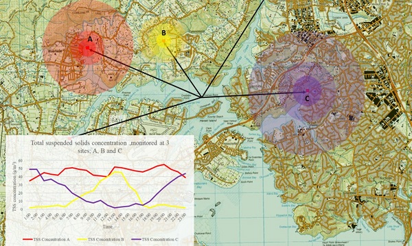
Spatial networks and timely, coordinated sampling over a catchment.
Catchment contaminant tracking

Spatial networks of instruments and/or connected real-time sampling systems in waterways are useful in understanding catchment contaminants from a source and apportionment perspective.
Whether it’s a first flush contaminant issue (where rain-fall criteria automatically trigger sampling networks), or continuous measurement and apportionment of nitrate ions or suspended solids at specific sources and/or tributary sources, we have a breadth of monitoring experience. Simple systems may demonstrate that a site operator is a minor source of a contaminant in a larger industrial estate.
Activities such as agriculture, industrial activities, construction, and earthworks can contribute to the total contaminant load in a catchment and knowing when these concentration spikes occur (eg. storm events) inform best practices to minimise environmental impacts.
